Think the View From Earth Is Amazing? Look at These Images of Antarctica From Space
Published Jan. 2 2024, 4:50 p.m. ET
Antarctica, the southernmost continent on Earth, holds a mesmerizing allure with its icy landscapes and unique ecosystem. Thanks to advancements in satellite technology, we now have the opportunity to observe this remote part of the world from space.
From melting ice shelves to live volcanoes, these images of Antarctica from space capture the dynamic nature of this polar region while providing valuable insights into the changes occurring on the continent.

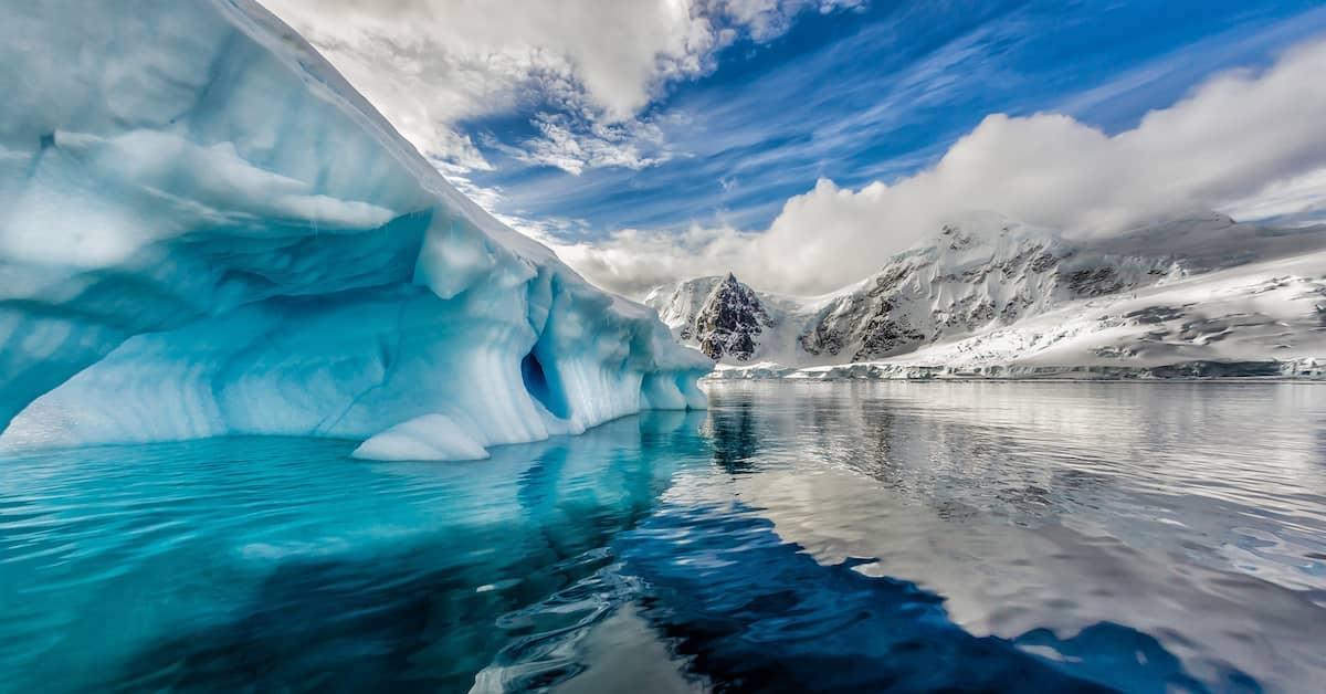
Satellites offer us jaw-dropping images of Antarctica from space.
Satellite images offer us a different (and humbling) perspective on the vastness and beauty of Antarctica. From expansive snowy plains and jagged ice shelves to the breathtaking glaciers that stretch as far as the eye can see, these images allow us to truly appreciate the scale and grandeur of this icy wilderness.
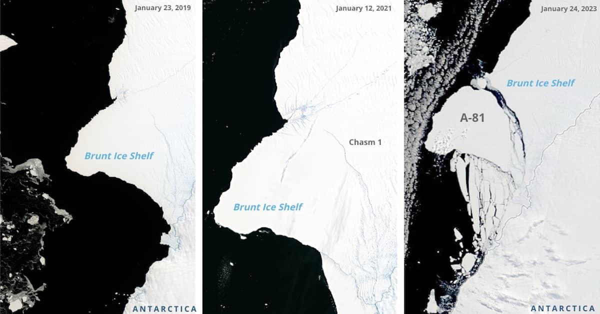
Brunt Ice Shelf: Iceberg A-81
In 2019, NASA Earth Observatory reported growing cracks across Antarctica’s Brunt Ice Shelf. Two years later, the iceberg — estimated to be twice the size of New York City — was still hanging on. The break finally took place on Jan. 22, 2023.
These three images show A-81 (as the iceberg was named) as it progresses from crack to calving.
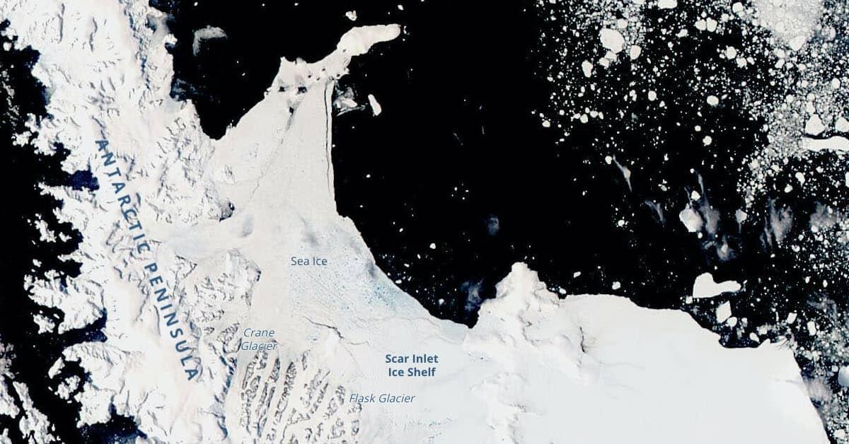
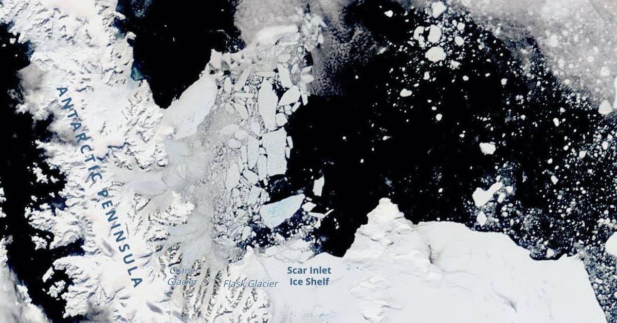
Larsen B Embayment
According to the Smithsonian, the waters around Antarctica freeze every winter, creating a thick layer of ice that makes the continent appear twice as big. In the summer, this ice breaks into floating pieces called pack ice.
In the two images below, taken by the NASA Earth Observatory on Jan. 16 and 26, 2022, you witness the Larsen B Embayment morphing from whole to shattered in a matter of days.
"Pyramid" in Antarctica's Heritage Mountain Range
In 2016, reports of a newly discovered pyramid in Antarctica (of all places) flooded the Internet. However, CBS News later reported that it was "just a mountain that looked like a pyramid." The video below offers a striking view of the pyramid-like mountain located within the Heritage Mountain Range in Antarctica.
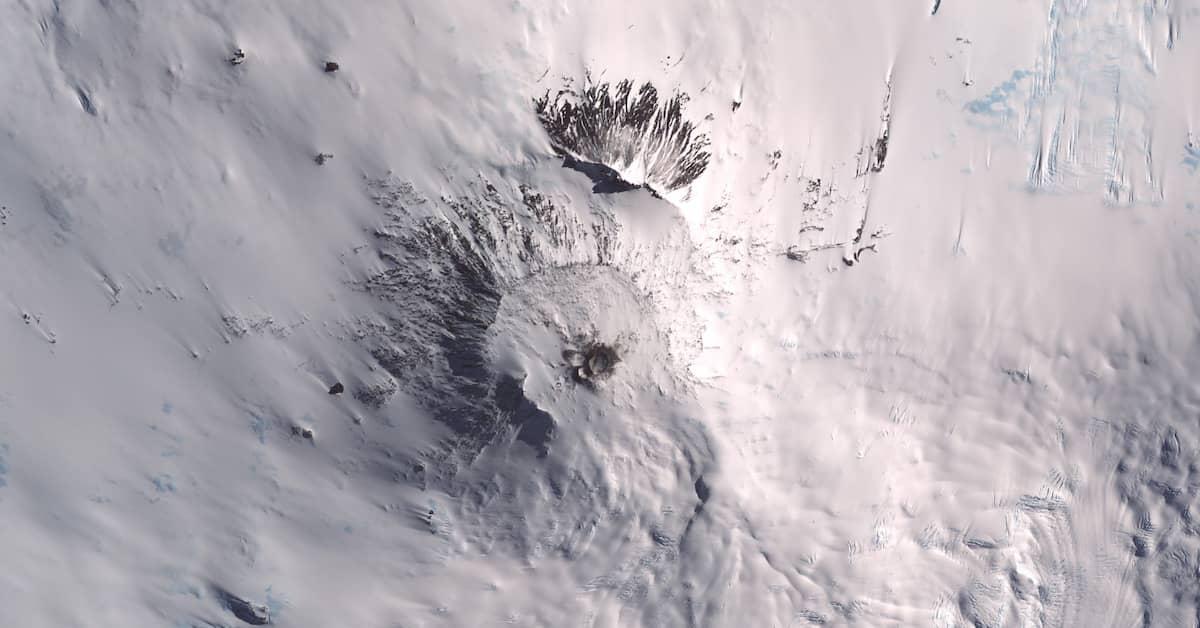
Volcano Erebus
Situated close to the South Pole on Ross Island, PBS says that Volcano Erebus is the southernmost active volcano on Earth and one of two active volcanoes in Antarctica. In this instance, viewing it from space appears to diminish its power. But it’s an interesting perspective nonetheless.
What we can learn by observing Antarctica from space.
The Landsat Image Mosaic of Antarctica (LIMA) provides a unique perspective on Antarctica, allowing us to explore its beauty and unravel its mysteries. And there’s a lot to unravel.
Observing this frozen continent from space gives us valuable insights into climate breakdown, environmental health, weather patterns, mapping, and scientific research.
Monitoring changes in glaciers, ice shelves, and sea ice from space helps us understand the impact of the climate crisis on Antarctica. This includes tracking the rate of ice melt, rising sea levels, and the influence on global climate patterns.
Satellite imagery also helps researchers monitor the health of Antarctica's ecosystems, including wildlife populations, vegetation distribution, and environmental concerns such as pollution and human impact.
Accurate observations of atmospheric conditions, cloud cover, and wind patterns in Antarctica contribute to more precise weather forecasting models. Finally, observing Antarctica from space aids in planning scientific expeditions and exploration, providing accessibility information, and assisting researchers in selecting locations for field studies.
Final thoughts.
If you're fascinated by Antarctica's extraordinary landscapes and scientific discoveries, it's worth delving deeper into the subject. Explore the resources available from organizations like NASA and the British Antarctic Survey to learn more about the wonders of this remote continent and the critical role it plays in our world.