How Real-Time Weather APIs Improve Disaster Preparedness
Published April 29 2025, 11:03 a.m. ET

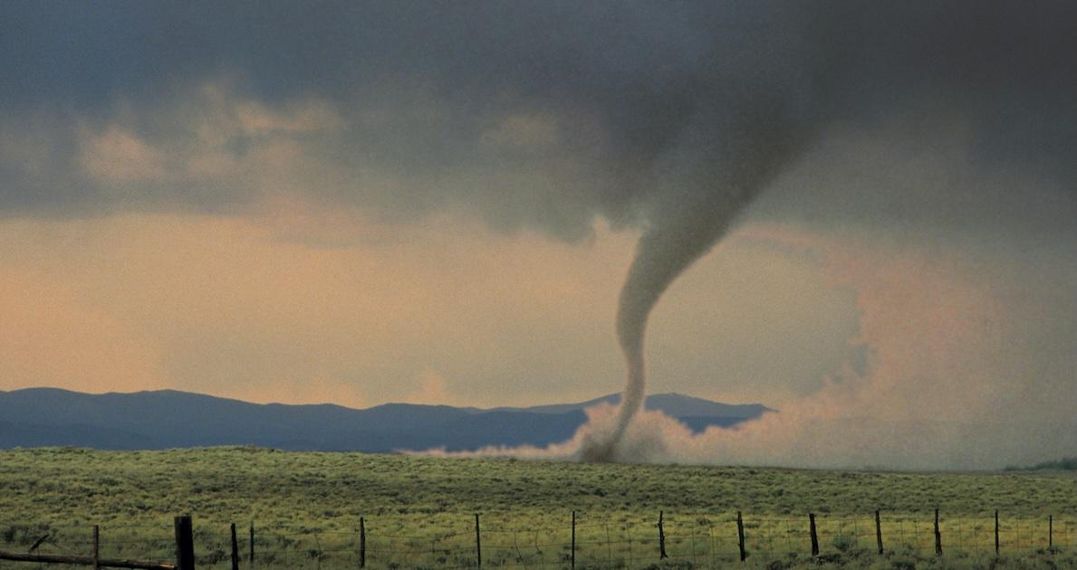
Every second counts when a disaster strikes. Weather-related disasters such as hurricanes, wildfires, flash floods, etc., share one critical variable – the timing of the warning. The difference between chaos and control often comes down to how early people get the right information. If they get it on time, they can prepare. If they don’t, then the risk of injury, infrastructure failure, and loss of life increases.
According to the National Centers for Environmental Information’s (NCEIs) "Billion-Dollar Disasters Report," since 1980, the U.S. has experienced 400+ weather/climate-related disasters, each causing at least 1 billion USD in damages (adjusted for inflation), totaling more than 2.9 trillion in losses and over 16,000 deaths.
If we had preemptive intelligent warning systems that could provide us with ample time to prepare, some of these calamities could’ve been better handled. These types of systems were developed using real-time data delivery mechanisms enabled by weather Application Programming Interfaces (APIs).
Weather APIs are digital tools that provide/deliver real-time meteorological data – such as precipitation rates, wind speed, and barometric pressure – pulled from radar systems, satellite telemetry, and ground-based observation stations.
What Weather APIs Do for Emergency Planning and Response
Forecast/weather APIs can play a pivotal role when it comes to planning how communities act during extreme weather.
Countries with less comprehensive Multi-Hazard Early Warning Systems (MHEWS) have a disaster-related mortality ratio nearly 6 times higher than that of countries with substantial to comprehensive coverage.
One of their biggest strengths is that they can improve early warning systems (EWS). When emergency managers can see accurate weather conditions in real time, they enable earlier issuance of geotargeted warnings via Common Alerting Protocol (CAP) systems, improving lead time for evacuation or shelter-in-place decisions.

Research, published in the journal Environmental Science & Policy, shows that if people are notified 12 hours in advance before a flood hits, damages can be cut by 60%. Even a 1-hour lead time can reduce damage by up to 35%.
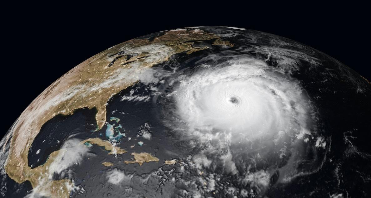
Look at what happened during Hurricane Ida in 2021, where the effectiveness and importance of early alerts generated by real-time data feeds were demonstrated. The storm brought heavy rain and flooding to the northeastern U.S. and caused at least 43 deaths. Because of current data, the National Weather Service (NWS) was able to issue flash flood emergencies and give people more time to respond. It proves how powerful fast, accurate information can be when lives are in danger.
Real-time weather tools can also help emergency teams make better decisions in the field. If they know exactly where the storm is headed or how fast the wind is picking up, they can support dynamic resource allocation using GIS mapping, which enables optimized routing for emergency responders and placement of logistical support units based on live Doppler radar data. Without this information, the choices are slower, less efficient, and riskier.
Another key application, though less frequently highlighted, is energy resource planning. Some APIs come with solar data, which is extremely valuable during disasters that knock out power.
Accurate and timely forecasts of solar irradiance levels (W/m²) inform emergency planners to assess feasibility and then optimize deployment of photovoltaic (PV) systems (e.g., solar microgrids), ensuring critical systems run, even during extended outages.
What to Look for in a Weather API for Disaster Preparedness
How well you’re prepared for a disaster depends on which tools are at your disposal. And this goes on all levels, whether you’re an individual, a part of a community, or a government body.
A good weather API can make all the difference; consider APIs that support high-resolution datasets (e.g., 1-km grid spacing), RESTful architecture for scalability, and integration with decision-support platforms through JSON or XML payloads.
Key areas of application include the following:

1. Improving Public Communication
During a disaster, one of the most important jobs is to get accurate information to people quickly and clearly. Weather data feeds help because they feed current updates into systems that send out alerts like text messages, emergency apps, and digital road signs. This helps people know what to do and what’s coming.
A study published in the International Journal of Disaster Risk Reduction found that delays in communicating flood risks can directly increase the chance of injury and death, especially in chaotic situations like flash floods and storms.
When warnings are late, people can’t react properly.
2. Infrastructure and Utility Management
Utilities and infrastructure providers use weather data to plan ahead. In 2021, during a winter storm in Texas, millions of people were left without power because demand spiked and equipment simply froze. If they had better access to current temperature forecasts, utility companies could have made adjustments on time or even just to warn people of possible outages.
Weather APIs that deliver live, location-specific updates can give them a way to do just that. This kind of preparation can help keep power, water, and other essentials running in times when people need them most.
3. Energy Forecasting Capabilities
In some disaster situations, access to power is no less important than access to information, which is why a reliable weather API should include solar data. Solar data helps those planning for emergencies and utility operators estimate how much energy solar panels can generate during or after a storm.
This is especially important in places that use solar-powered microgrids, like Puerto Rico, where, thanks to initiatives such as the Puerto Rico Energy Resilience Fund (PR-ERF), rural communities are being kept together and connected via energy. Rural clinics and water systems all rely on these setups to stay in operation during blackouts.
When a weather data feed API can accurately forecast solar radiation, critical infrastructure can keep running.
4. Long-Term Planning and Risk Assessment
Real-time updates can mean the difference between life and death during a crisis. But long-term planning depends on how well we understand the patterns from the past. Programmable weather APIs offering historical climatological datasets(e.g., 30-year normals, anomaly indices) enable trend analysis, hazard modeling, and integration into hydrological simulation tools such as HEC-RAS or FEMA’s Hazus.
They could map out areas that are most at risk and invest in upgrades before the next disaster hits.
For instance, a study titled "Co-producing new knowledge systems for resilient and just coastal cities: Lessons from the U.S. Gulf Coast" looked at how historical data supported resilience planning in the coastal cities of the U.S. It helped local governments make decisions about zoning, floodproofing infrastructure, and updating building codes to be better prepared for the climate challenges in the future.
Conclusion
There’s no time to wait when a disaster is on its way. Decisions have to be made in a split second, and what’s even more important, they have to be right.
This is why weather APIs are so integral; they facilitate integration into automated EWS, support grid operators with predictive load balancing, and they can enable real-time risk assessment and mitigation using actionable meteorological intelligence.
We live in a world where the weather is becoming more and more unpredictable, and considering that only about 50% of countries worldwide report having the capability to alert citizens about impending hazardous weather conditions, we as a people still have a long way to go.
The smartest move anyone can make is to be ready. With real-time weather tools combined with the right data, that’s more than possible.