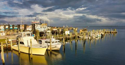
Hatteras Island Is Being Evacuated as Residents and Visitors Brace for Hurricane Erin
The storm system is expected to bring life-threatening conditions to the region.
Published Aug. 18 2025, 2:50 p.m. ET

Hurricane Erin made headlines on Aug. 15, 2025, when it went from a Category 1 hurricane to a Category 5 hurricane in just 24 hours. While the Atlantic-based hurricane is expected to remain off the eastern coast of the U.S., officials issued a mandatory evacuation for the most vulnerable areas along the country's coast, like North Carolina's Hatteras Island.
The evacuation order was put in place days before the hurricane is set to pass by the island due to expected coastal flooding.
Officials expect the island to begin to see the effects of the hurricane as early as the morning of Aug. 19. Of course, the timing and path of the storm remained unclear, even as evacuation orders were issued.
This is largely due to the unpredictability of a storm this size, especially when it's running through the warm waters of the Atlantic Ocean, and experts say that storms like Erin are becoming increasingly more common thanks to the rising ocean temperatures brought about by climate change.

Officials issue a mandatory evacuation order for Hatteras Island.
Dare County officials met on Aug. 17, 2025, to review the most updated storm center predictions from the National Weather Service (NWS) office in Newport/Morehead City, according to a statement posted to the county's website.
During that meeting, senior leaders decided to issue a mandatory evacuation of Zone A, an area that includes the entirety of Hatteras Island as well as "the unincorporated villages of Rodanthe, Waves, Salvo, Avon, Buxton, Frisco, and Hatteras."
The evacuation was required to begin Aug. 18 at 10 a.m. EST, according to officials, and everyone was required to be off the island by 8 a.m. the following day, which is when the storm effects are expected to begin.
The evacuation was issued due to concerns of both ocean over wash and coastal flooding, which officials said would likely make it impossible to travel parts of Highway 12 for several days at a time.
Hurricane Erin's path has shifted several times since the storm formed.
As of Aug. 18, the National Hurricane Center said that Erin would once again strengthen, and the organization predicted that it would "remain a large and dangerous major hurricane through the middle of this week."
Fortunately, the U.S. is not expected to see any direct impact from the storm. However, the record-breaking size and strength and close proximity are set to put several areas in danger of tropical force winds and storm surges, according to NBC News.
Officials are also warning beachgoers across the East Coast to beware of intense rip currents and surf conditions, which they say could be life-threatening at times. In fact, 20-foot swells are expected to crash onto the shores in some regions, which could cause significant destruction to sand dunes and increase erosion.
Erin is the first Atlantic hurricane of the year. Hopefully, she isn't a sign of what we can expect for the remainder of the 2025 hurricane season, which runs into November.