Scientists Can Now See Earth’s Carbon Stores from Space in Unprecedented Detail
Published Feb. 4 2026, 8:08 a.m. ET

A striking visual of the landscape surrounding Bolivia's Beni River captured by the ESA's Biomass satellite.
A satellite image has unraveled a first of its kind view of Earth. The European Space Agency's (ESA) Biomass satellite captured biomass surrounding a winding river in Bolivia, and it doesn't look less than an abstract painting. The false-color image showed bright hues of green, purple, and more, highlighting the rich landscape surrounding Bolivia's Beni River. The green color in the image depicts rainforests, whereas the purple indicates grasslands. The slight hint of reddish-colored marks wetlands in the area, and the rivers and lakes surrounding those wetlands appear black. The satellite uses polarized radar to scan the Earth's surface, catching biomass differences that would otherwise go unnoticed. Hence, the intricate details denoted by false color give a better picture of the ecosystem around Bolivia.
The satellite images are the first of their kind, and researchers believe that it's just the beginning. According to Michael Fehringer, an ESA scientist and Biomass project manager, the "first images are nothing short of spectacular — and they're only a mere glimpse of what is still to come." These images will help analyze the carbon-rich areas and understand how the ecosystem reacts to external stressors induced by human activities. While climate change is a natural stressor, the area is also a victim of large-scale deforestation. Bolivia is one of the most affected countries due to deforestation, ranking high in the list of primary forest loss across the globe. Agricultural expansion is one of the major factors contributing to the loss of forests and deforestation. Its vast spread across the landscape can only be understood with large-scale and intricate data provided by the biomass satellite.
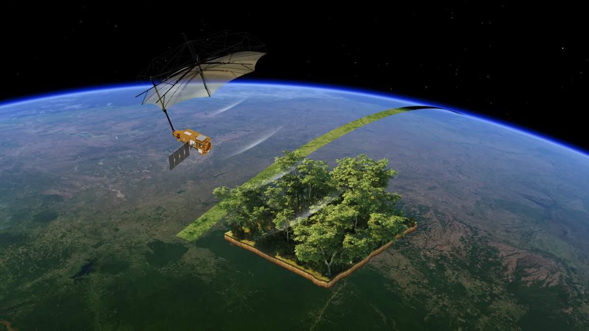
ESA’s Biomass is the first satellite to carry a P-band synthetic aperture radar, which is able to penetrate through the forest canopy, allowing it to collect information on different parts of the forest.
The picture shows a vast land about 56 miles long and 37 miles wide, surrounding the Beni River. The convoluted black streaks in the middle depict waterways that originated in the Andes and are flowing to Brazil to merge with the Amazon River. “Looking at these first images, it’s clear to see that our Earth Explorer Biomass satellite is set to deliver on its promise," said ESA’s Director of Earth Observation Programmes, Simonetta Cheli. “We fully expect that this new mission will provide a groundbreaking leap in our ability to understand Earth's forests – combining cutting-edge radar technology with the scientific excellence that will unlock vital insights into carbon storage, climate change, and the health of our planet’s precious forest ecosystems," Cheli added.
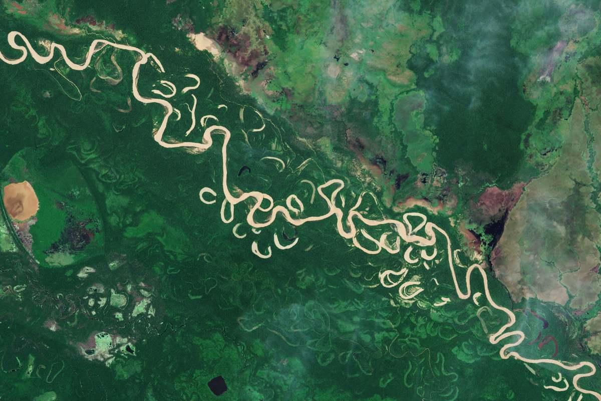
An image of the same area from Copernicus Sentinel-2.
The tributaries of the Amazon Basin are unique in their own right. Some might show a steady stream, while others move dramatically, dodging hurdles on the way. The Beni River, as seen in the images, comes under the latter category, flowing haywire and making convoluted streaks. While the satellite images managed to intricately capture the details of the landscape, researchers believe that the key to breakthrough discoveries lies in the analysis of these images. The satellite images combine the unique sampling technique and multiple observations of the same area that recorded forest height and biomass.
These detailed images help researchers accurately analyze carbon-rich lands and understand the role of tropical forests in the world's carbon cycle. Besides the Beni River, the satellite has scanned the landscape around several rivers, all crucial to maintaining a healthy rainforest ecosystem. The satellite scans the Earth's forest-clad landscapes every six months.