A River Flowing 'Uphill' in Colorado Has Puzzled Scientists for Decades. Now, They Finally Know Why
Published Feb. 3 2026, 7:45 a.m. ET

Steamboat Rock and Green river at Dinosaur National Monument, Colorado
In a Y-shaped patch of the Canyonlands National Park, the greenish-blue waters of the Green River merge with the muddy waters of the Colorado River, a meeting that has puzzled scientists for years. The Uinta Mountains, which stand as a barrier between the two rivers, should have blocked their meeting. But since it didn’t, scientists were compelled to assume that the Green River travelled uphill, over the Uintas, to shake hands with the Colorado River. But how can a river flow upwards?
In a study published in the Journal of Geophysical Research: Earth Surface, scientists picked up this long-standing mystery and proposed that it wasn’t really the river that flowed uphill. It was the mountains that sank lower. A phenomenon they called “lithospheric drip.”
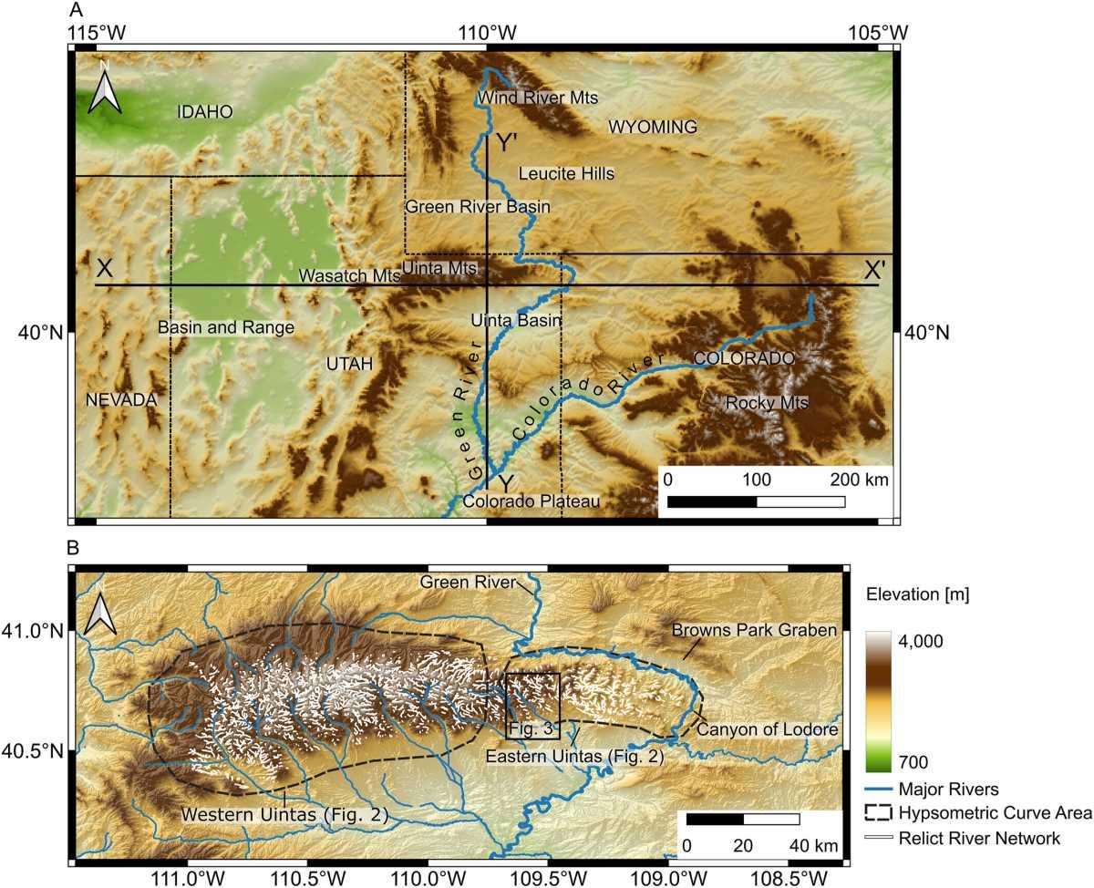
(a) Regional map of the western USA centered on the Uinta Mountains. X-X′ and Y-Y′ are the lines of section for seismic tomography results. (b) An elevation map of the Uinta Mountains
The Green River, the largest tributary of the Colorado River, traverses a meandering path before ultimately intersecting. But the missing piece of this puzzle remained a question: How exactly did Green River wind through the Uintas? Flowing uphill sounded like a good fantasy scene, but not something that scientists could believe. How can someone believe that a river defied all laws of gravity to meet another river?
“For about 150 years now, geologists have debated over exactly how the rivers merged, which is a particularly challenging question for a tectonically inactive area where major geological events are rarer,” lead author Adam Smith said in a press release. Smith and his team studied the timeline of incision rates and geomorphology of the Uintas to understand how this landscape and topography evolved over millions of years and how the Green River took advantage of this changing geometry. They found that the Uintas willingly supported Green River by dripping to a lower elevation, a phenomenon called lithospheric drip.
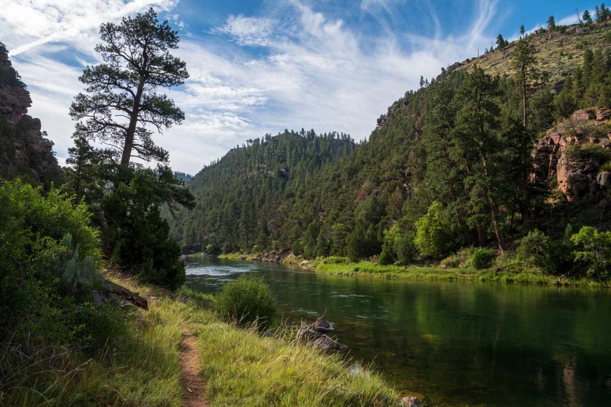
Green River flowing through the Flaming Gorge
Between 2 and 5 million years ago, the Uintas encountered massive erosion and gravitational collapse that led to some topographic transformations. Sometimes, events like these form high-density blobs between the outer crust and the mantle. Over time, these blobs start dripping and dragging the mountains lower. Eventually, the mountains plunge to lower elevations due to pressure, and the blob breaks and detaches. The mountains form canyons as they sink lower, in a process called isostatic rebound.
So, while the Uintas underwent a rebound effect, the Green River took advantage and travelled the “path of least resistance” to meet its beloved Colorado River. As the two met, they created a boundary line, the ancestral continental divide of North America, separating the rivers that flow into the Pacific from those that flow into the Antarctic. Fish species got mixed, and this one meeting created new boundaries for wildlife, supporting their evolution.
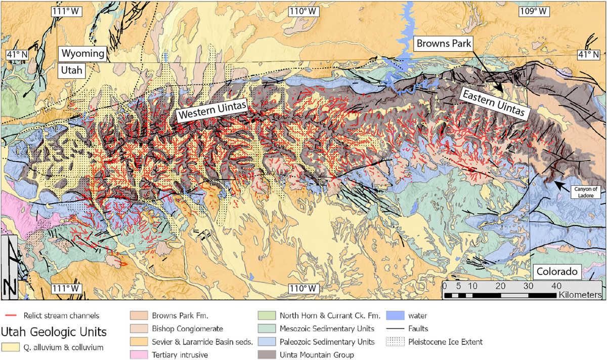
Key lithologies of the Uinta Mountains and their periphery are highlighted
This conclusion, however, didn’t come without a little bit of mathematics. Initially, two hypotheses were laid out on the table. Either it was a headward erosion from the south or a capture of the Green River from the north of the range. Erosion from the south seemed like an unsatisfactory answer, because to travel south of the mountains and cut northward would require the Yampa River to exert tremendous force, something that it isn’t capable of. The second possibility was that sediments accumulated and paved the way for Green River, but since neither of the canyons is higher than the canyon through which it flows, this hypothesis was also ruled out. This left them with only the theory of lithospheric dripping.
They studied seismic tomography images and found a blob 120 miles beneath the surface, which provided clues to Green’s meandering journey through time. The most exciting part of the study, as geologist Mitchell McMillan at the Georgia Institute of Technology shared with Live Science, was that it uses clues on Earth’s surface to understand the deep mantle’s processes and how they impact mountain belts. "Whether or not the drip hypothesis ultimately ends up being correct here, this study is a valuable demonstration of such an approach," he said.