China Successfully Turns Gobi Desert Into a Green Belt. But It's Caused a Dangerous Side Effect
Updated Feb. 19 2026, 4:53 a.m. ET

Gobi Desert scenery, Xinjiang Province, China
For years, the gradual expansion of the Gobi Desert has been a threat. Environmentalists feared that the desert would encompass valuable assets of nature—livestock, wetlands, and more. To prevent the potential widespread destruction, they planted millions of trees. However, the conservation effort to save the Gobi Desert surfaced a new, more concerning issue. Even though the mission was a success, it reduced water availability in parts of the country. According to a recent analysis published in Earth's Future, the large-scale tree plantation increased rainfall. But the trees drew moisture from soils and aquifers and reshaped the course of water's flow. So, it redistributed the water, shifting who benefits from the change and who bears the cost.
Satellite reports from 2001 to 2020 highlighted how the country turned greener over the years, but the water stress increased in prime regions. Dr. Qiang An, co-author of the study, traced the water flow beneath the green lands and detected an interlink between the changing landscapes and water distribution in the region. The analysis conducted by a research team from China Agricultural University (CAU) uncovered a weird irony. Even though rainfall increased, the water within soils, rivers, and groundwater showed no difference, as if an imposter stole away water. Indeed, it was the large-scale tree plantation that caused this imbalance. The thick, tree-covered landscape gives an illusion that the country's getting greener while camouflaging a bigger problem underneath.
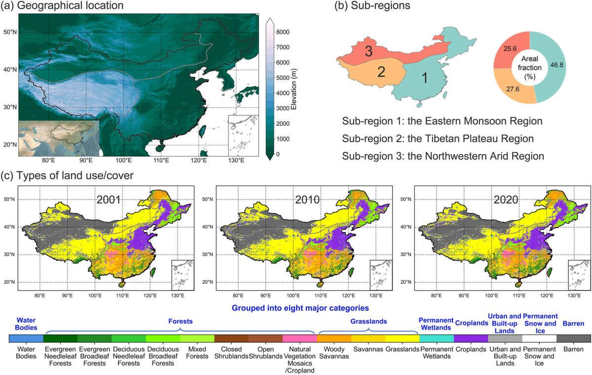
Geographical location (a), sub-regions (b), and land use/cover types (c) of China.
How are trees using up water? Through the process of evapotranspiration, water from the soil and leaves is moved into the atmosphere. During dry periods, the scarce rainfall forced the growing trees in the region to pull more water from the underground trapped water that their roots could easily reach. So, in arid landscapes such as the Gobi Desert, where water is already limited, this extra consumption of moisture further increases the risk of water shortage. People who depend on underground reservoirs for water will face issues of limited water supply. The water vapor produced by millions of planted trees did not return to Earth in the same region.
According to the study, winds carried the moisture-locked clouds far away. In the process known as moisture recycling, water vapor turns into rainfall, returning the water to the same area. However, the vapor collected through the Gobi Desert didn't return water to the same region. An’s team found that downwind areas received rainfall, whereas the upward soils dried out. The local plantation mission might look successful, but it is gradually draining water from nearby farms. The mission of planting green belts across areas started as part of the Three-North Shelterbelt Forest Program and is planned to run until 2050. The officials initiated afforestation and found reduced wind erosion and increased greenery.
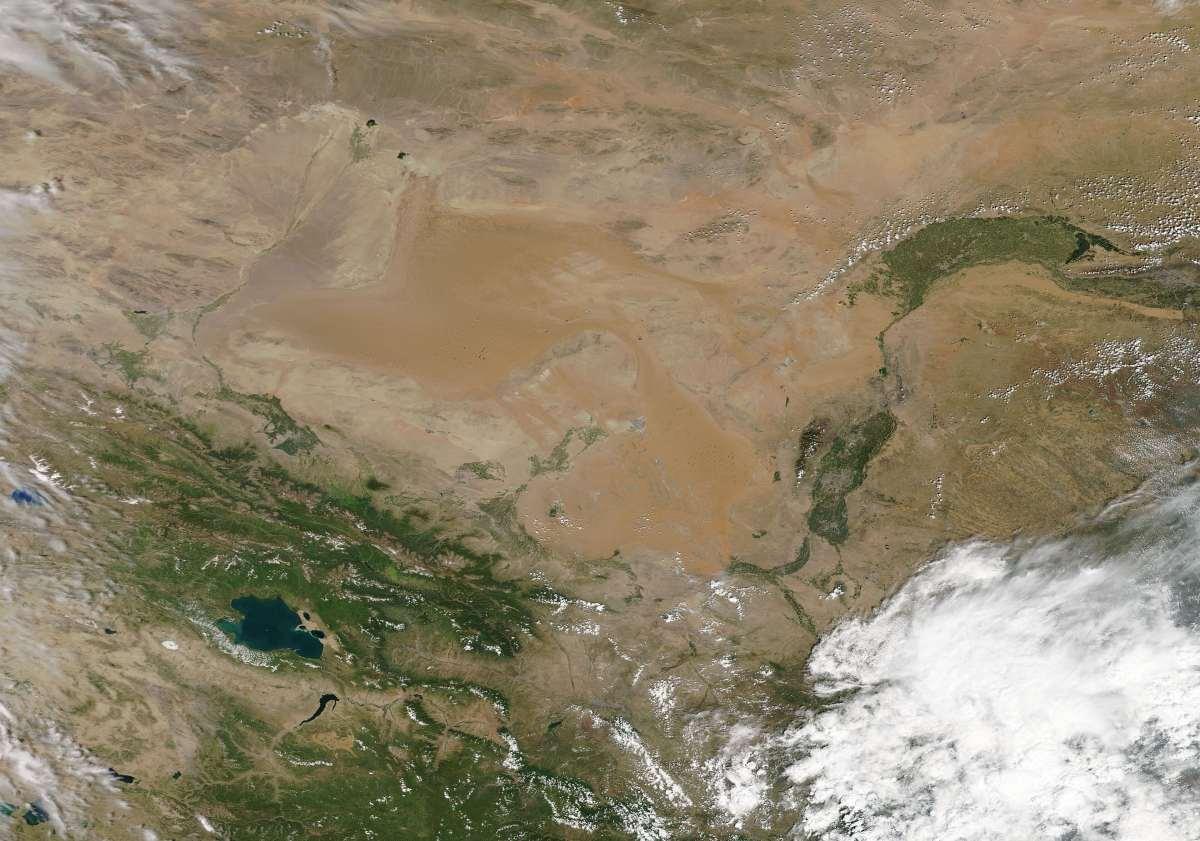
On August 13, 2017, the Moderate Resolution Imaging Spectroradiometer (MODIS) aboard NASA’s Aqua satellite acquired a true-color image of the Gobi Desert.
However, the issue of water scarcity didn't come to light until communities started facing shortages. The researchers relied on river gauges in Chinese watersheds to understand how the afforestation reshaped the water cycle. Dry basins witnessed a decline in runoff, while wet southern basins showed no change in runoff rate. “The study underscores the necessity of integrating moisture recycling into water resources management to address the mismatch between land and water resources,” An wrote.
It's essential to treat water as a limiting factor in future conservation plans. These greenbelts might look like progress, but they are secretly causing a bigger problem. The researchers emphasize taking local surveys of streamflow and soil moisture into consideration before laying out a plan for large-scale afforestation.