Record Arctic Blast Created 'Cloud Streets' Over Atlantic. NOAA Captured Its Stunning Visuals
Published Feb. 6 2026, 9:19 a.m. ET

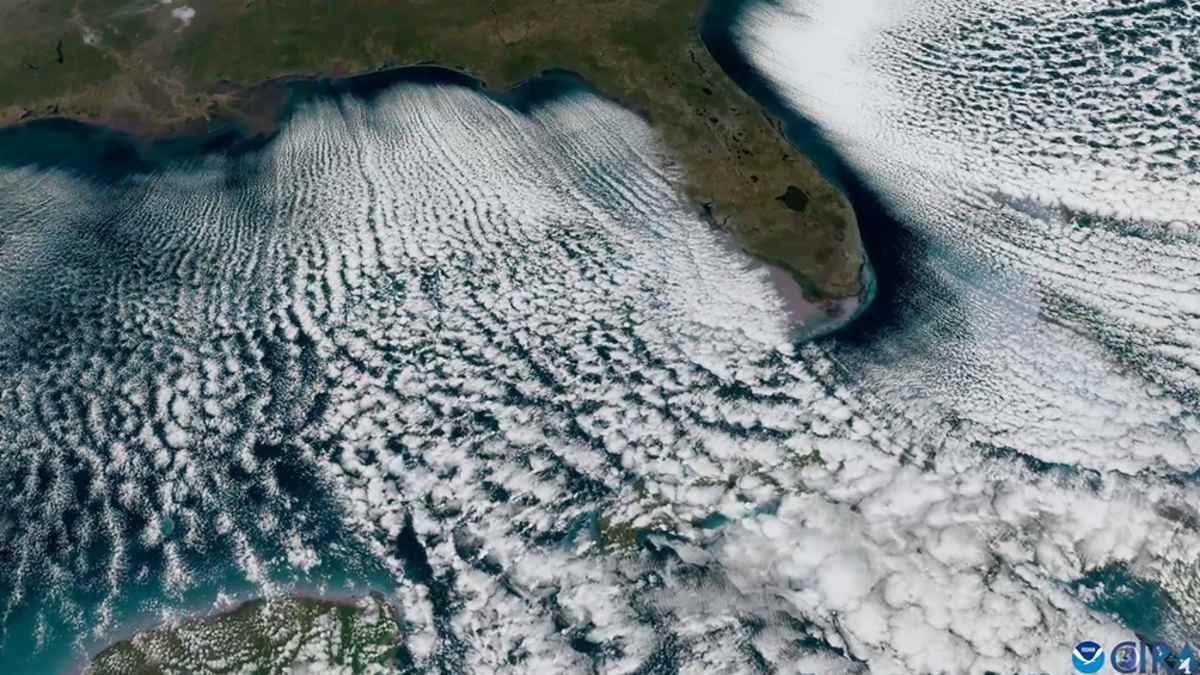
A snapshot from the 15-second footage NOAA shared of the surreal 'cloud streets'
Last weekend, an Arctic blast smothered most of the mid-Atlantic and southeastern United States in a ghostly deep freeze. Ice climbed on the towers while oceanfront houses collapsed against the whorls of the storm. Polar jet streams ruptured the power plants, and howling winds left nothing intact. Tree limbs were brutally ripped from the trunks, and iguanas were jolted out of their element. When everything was powerlessly busy surrendering to this violent tempest of ice and gusty currents of wind, somewhere over the waters of the Gulf and Atlantic, a piece of artwork was materializing above the churning swells of water. NOAA’s geostationary GOES-19, or GOES East satellite, recorded footage of this otherworldly appearance on February 1. The satellite's Advanced Baseline Imager (ABI) captured the dreamlike visuals while it hovered in orbit.
NOAA’s GOES East satellite captured long, parallel bands of clouds called horizontal convective rolls
The 15-second footage shows long, parallel bands of clouds rippling through the atmosphere. Fast-moving jet streams of puffy, milky-white material erupt and ripple through the sky in massive fluid animation, carving what looks like an intricate lacework in motion. From the perspective of scientists, however, this is something called “horizontal convective rolls,” a phenomenon that occurs as nature’s attempt to balance out its thermal energy, as NASA also explains.
When the waters are warm and the air above is cool, the heat of the water rises above to contact the cold, dry air. As it does, the air becomes excited with the warmth and starts rising and falling, jumping towards a stable thermal layer of air swimming above. As it touches it, the air condenses and starts generating frozen droplets, which magnify to form cumulus clouds. Eventually, these clouds align themselves with the direction of the wind and initiate this swirling motion.
Cloud Streets over the Atlantic
As observed in the footage, the trails of clouds have gaps that reveal the clear blue skies. These gaps are left out due to the differences in time and distance the cold air takes to trap the heat and moisture from the water below and form clouds. Air is forced to flow through these alternating layers of cloud, forming "cloud streets." According to NASA, cloud streets don't just form over the open ocean' they could often be spotted over the Great Lakes during cold spells (pictured below). Thanks to the high-resolution image-capturing ability, this rare phenomenon was captured in vivid detail. The satellite, NOAA remarked, has skillfully recorded similar snapshots of everyday weather, winter storms, tropical storms, and hurricanes in striking accuracy.
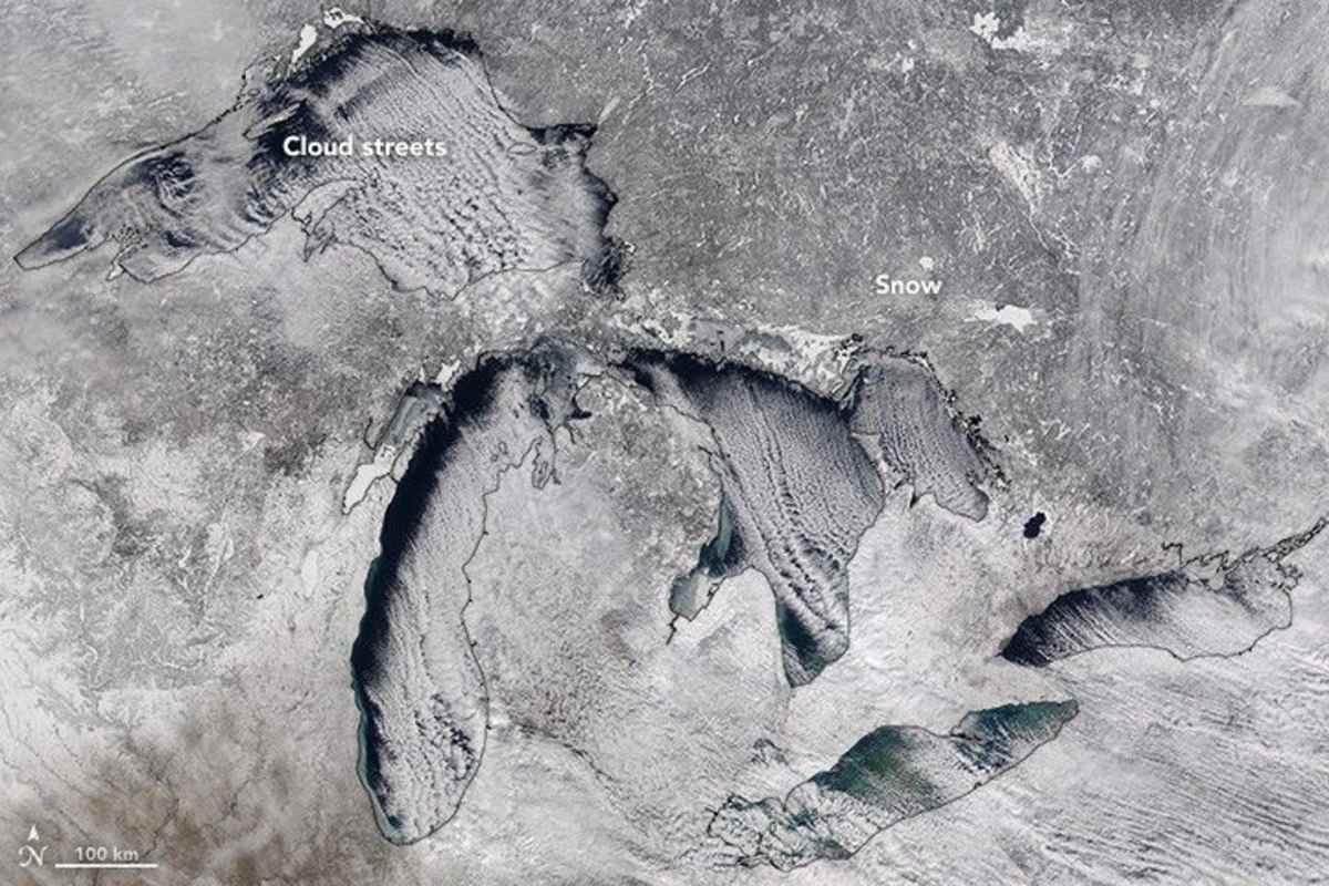
Cloud Streets Over the Great Lakes
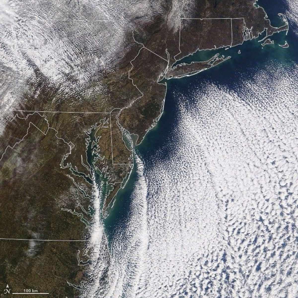
Meanwhile, the southern United States, including Florida, continues to grapple with the freezing temperatures. The aggressive blast that plunged the landscape under a numbing blanket of ice was one of the coldest Florida experienced in the past few years. “Temperatures dropped to 23 degrees Fahrenheit in Winter Haven, 29 degrees in Tampa, 30 degrees in West Palm Beach and 35 degrees in Miami,” noted the space-weather monitoring government agency.