Rare Footage Gives a Closer Look at How Earth’s Surface Moves During a Major Earthquake
Published Aug. 29 2025, 12:45 p.m. ET

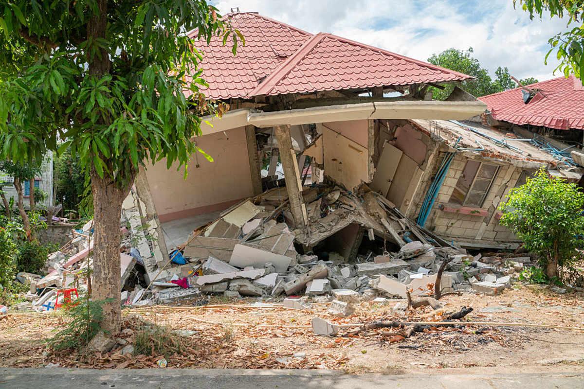
Damages from a 7.7-magnitude earthquake that hit Myanmar on March 28
Even Buddha’s divine energy can’t prevent humans from going through pain and devastation. On March 28 this year, a dramatic dance happening between the crusty tectonic plates erupted into a violent tremor that shook the entire country of Myanmar. The “Land of the Golden Pagoda,” typically clustered with Buddhist temples, where monks in maroon robes roam and meditate, shuddered and then collapsed in heaps of rubble and ash. Roads got buckled, trees flattened, and buildings crumbled. Rooftop pools spilled over the sides of swaying buildings, and the entire Earth seemed to lunge and lurch sideways, shaking like a leaf.
Residential buildings in Myanmar were damaged and inhabited after the earthquake
The traumatic event even caused architectural jewels like the Mahamuni Buddha temple and Hsinbyume Pagoda to disintegrate, tumble down, and fall to pieces. The entire nation of gemstones broke apart into fragments. In a study published in The Seismic Record, a team of geophysicists documented the details of footage that captured the first-of-its-kind visual evidence of this quake’s plate tectonics in action.
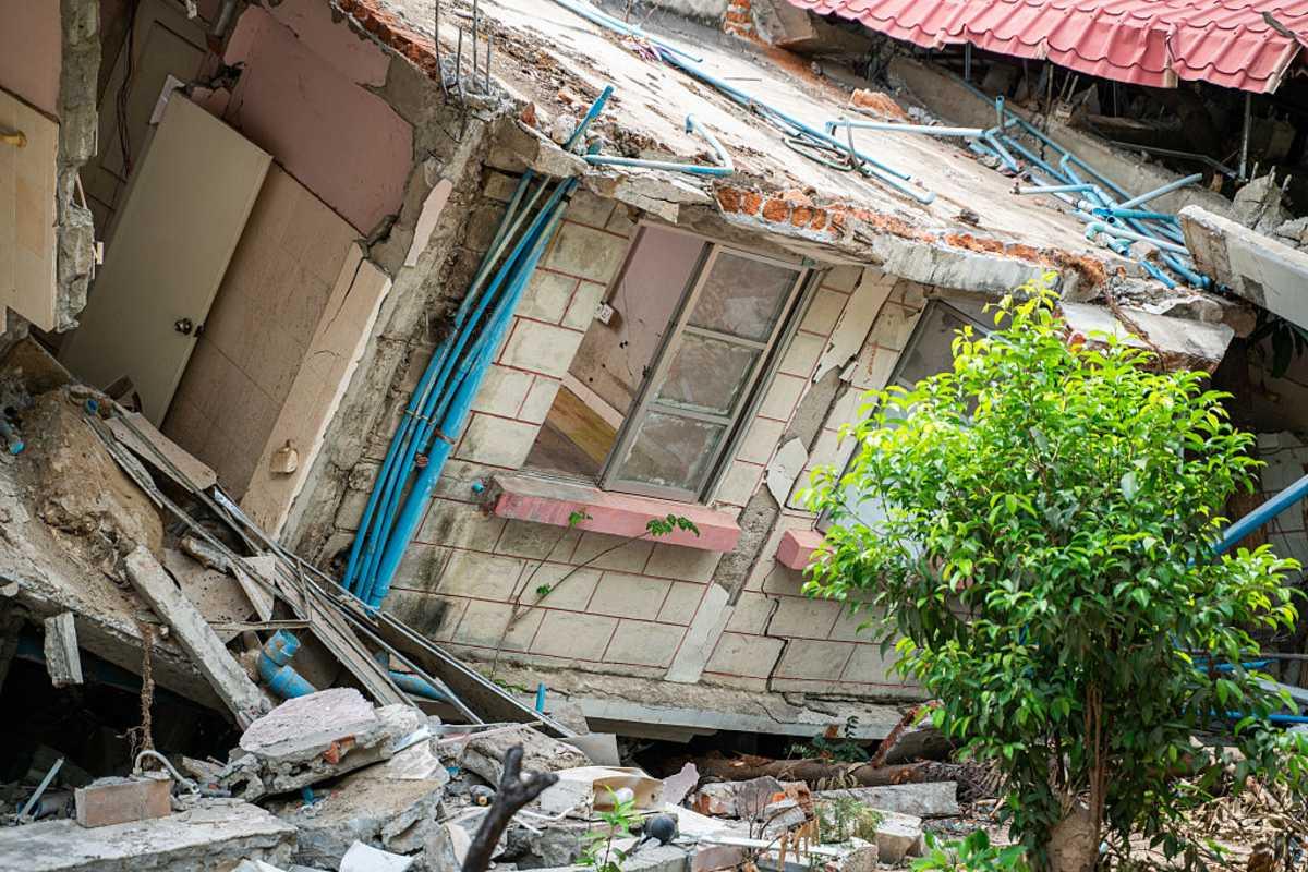
Residential buildings in Myanmar were damaged and inhabited after the earthquake
The footage was recorded by a security camera near Thazi, Myanmar. The 26-second video shows a black grilled gate flanked by solid grey walls with garden patches on either side. In the background appears a vast soil plain, with valleys dotted with clumps of bushes. One side is peppered with little hut houses, while an electric antenna tower stands on the other. About 11 seconds into the footage, the ground starts shaking, starting from a subtle quiver to intense, violent convulsions.
The gate bursts open, and within a few moments, the antenna tower in the backdrop appears to be crumbling and bowing down to the ground. Creases appear in the dusty-baked ground in front of the gate. Plants rustle wildly in the agitated winds, and then the video cuts to black. According to the study, this pulse-like rupture was recorded during a magnitude 7.7 earthquake that hit Myanmar on this day, around early afternoon.
Commonly, tectonic plate boundaries are where chunks of Earth’s crust, also called plates, slide past each other, sometimes smoothly, sometimes in violent ruptures. Out of this crashing and colliding emerge land formations like mountains and oceans. It is only quakes like these that have given form to the Alps, the Himalayas, and the Rocky Mountains.
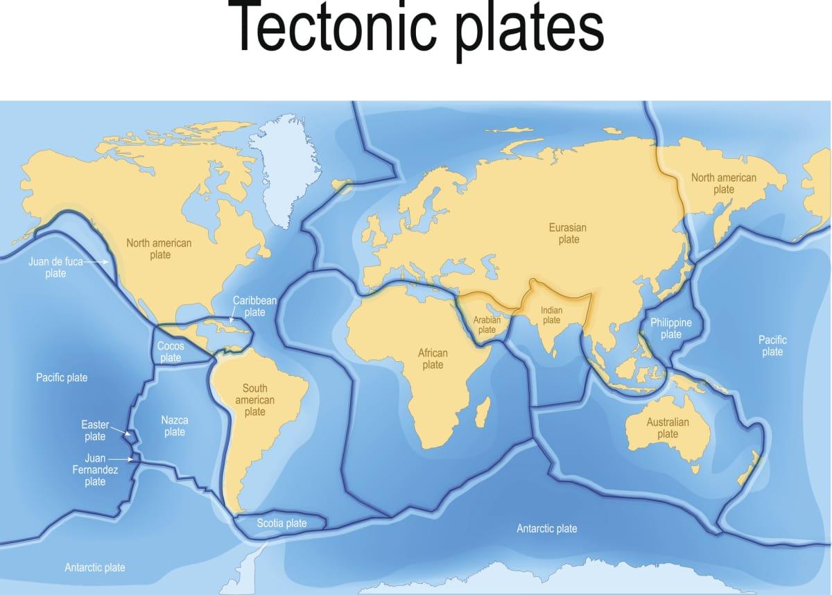
Tectonic plates on Earth
Researchers noted that the earthquake caused a rupture of about 290 miles along the Sagaing fault line that runs through the middle of Myanmar, which caused the shaking of up to intensity X on the Modified Mercalli scale, according to the footage’s YouTube description. Documenting the description in their words, the geophysicists wrote that the short duration of motion reveals a “pulse-like rupture,” a concentrated burst of slip that propagated along the fault line like a ripple travelling down a rug when it is flicked from one end.
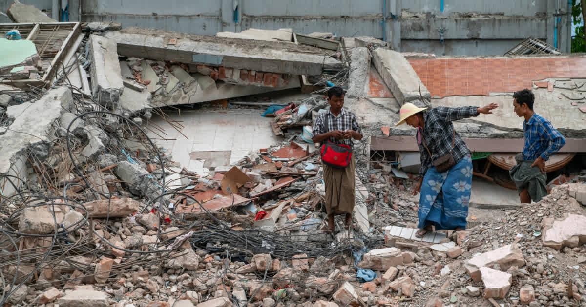
People are seen cleaning up after the destruction caused by the earthquake
Geophysicist Jesse Kearse, a postdoctoral researcher from Kyoto University, said he watched the footage shortly after it was uploaded on YouTube. In the aftermath, he and his colleague, geophysicist Yoshihiro Kaneko, analyzed the video in detail to unleash some noteworthy insights on how sudden earthquakes like these unfold.
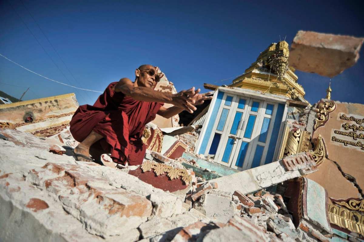
A monk clears debris off a destroyed Pagoda after an earthquake in Myanmar
Their first observation, after analyzing the footage from a pixel cross-correlation analysis, was that the crack erupting open in the ground was curvy. They noticed that the crack curves sharply at first and then accelerates to a peak velocity of about 10.5 feet per second of movement, slipping a total of 8.2 feet in 1.3 seconds, according to Live Science. After hitting its greatest velocity, the crack settled down, slowed down, and straightened. Their findings suggested that the curvature occurred because stresses on the fault right at the ground surface were lower than the stresses on the fault deeper in the Earth. This created an uneven pattern in how the fault moved during the earthquake.
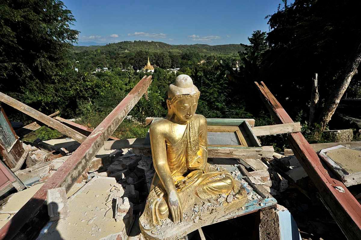
A Buddha statue is seen among the debris after an earthquake in Myanmar
Essentially, the curvature told the main story of the dynamics of the rupture. Its understanding would reveal fascinating clues about what triggered the past earthquakes and help scientists predict future ground ruptures for the better. From the geological perspective, the curvy movement refers to “slickenlines,” scrape marks on the sides of faults, as Kearse revealed. Geologists had known about these marks for decades, but never saw them in action.