Ancient Freshwater Reservoir Found Beneath Great Salt Lake Defies Scientists' Expectations
Published Feb. 2 2026, 6:11 a.m. ET

Satellite images show dozens of small, circular features along a drying lakebed in Utah's Great Salt Lake.
Years ago, hydrologists Ebenezer Adomako-Mensah, Bill Johnson, and Kip Solomon were examining data sent by NASA’s Landsat satellites when some photographs jolted them into immense curiosity. They hopped aboard snow bikes, hauling bags of garden tools to investigate what they called the “mystery islands.” These tiny islands, hugged by bushy clusters of tall grasses, were spotted deep within the heart of southeastern Utah, in the swampy fields of Farmington Bay, bordering the Great Salt Lake (GSL) playa.
For the past two years, they have been visiting the bay regularly via airboats and mountain bikes, digging white pole-like sticks, a.k.a. piezometers, into the beds of coarse sediment muds, and recording interesting observations from electrical resistivity wires. In a study published in the Journal of Hydrology, Adomako-Mensah documented the discovery of a large, pressurized reservoir of freshwater lurking thousands of feet below the playa. Deep in the underbelly, thick profiles of salt layers are protecting this wellspring of freshwater.
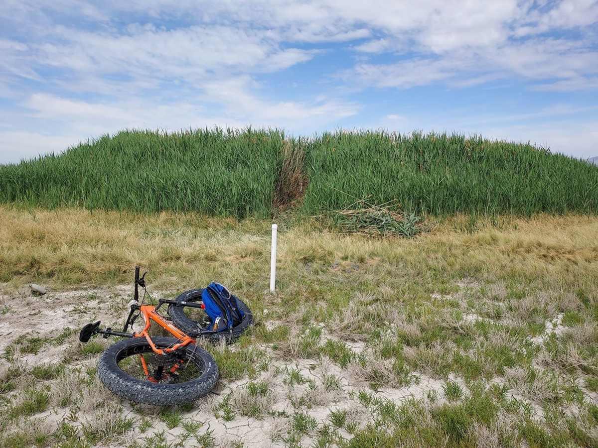
The photograph above shows an example of one of the mounds in Ogden Bay just southeast of the Landsat image that the researchers call "Round Spot 8.”
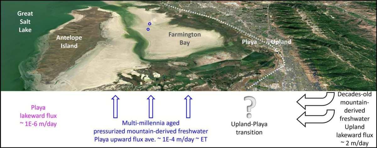
The mystery mounds hydrologists uncovered represent the underground boundary where saltwater meets the freshwater, where freshwater is pushed under pressure through a layer called “saltwater lens.” The discovery of this breaching lens was the starting point that initiated this research. To have such a tremendous well of freshwater sloshing in the bosom of GSL is nothing short of ecstasy. The tiny mystery islands on the surface provide clues to the areas where suppressed groundwater succeeds in finding a path upwards. And although salt barriers prevent these waters from springing up, when they find a way, they seep through narrow, circular openings, laced with reeds.
Researchers say this lagoon of untouched freshwater carries water from thousands of years of snowmelt, which dribbled down the mountain slopes and, over the years, seeped through the subsurface cracks, collecting here. It is concealed by a layer of salt roughly 30 feet thick.
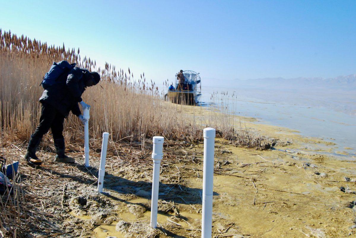
Ebenezer Adomako-Mensah collects piezometer data on a mound formed in Farmington Bay where groundwater breaches the surface of the Great Salt Lake playa.
They utilized a suite of different tools and techniques to process this data. For instance, the isotope analysis was used to determine the age of groundwater, the recharge elevation, and the location where it originated in the mountains. The electromagnetic data collected from airborne geophysical surveys were used to construct a 3D image of the playa’s deep subsurface. The goal, they said, was to map how deep and extensive this freshwater reservoir is, to analyze its chemical makeup, and, if possible, its age. All these details could help them better understand and manage the water sources beneath the lake.
When Johnson views the playa, the mystery islands, and now the freshwater, he views it as an aquifer with enormous potential to replenish the drying lake, to restore the lakebed crusts, and to naturally prevent exposed sediments from contributing to dust storms blowing into Wasatch Front cities. He noticed that the water in the center of the mounds was freshwater, and as they moved closer to the edge, it became saltier. He and his fellow researchers proposed that if they drop a well and flood the dry area, the dust spot could be doused off without weakening the nice upward pressure, as he explained.
Graphical abstract showing the underwater freshwater reserve.
Terminal lakes like the GSL are harbingers of hydroclimatic change worldwide and hence are more vulnerable to the impacts of increased temperature worldwide. The shrinking footprints of the lake, when mobilized by dust and propelled by winds, can contaminate the air in adjacent and surrounding populations. Being the largest saline lake in the western hemisphere, the GSL can provide a wealth of insights about how to avoid this incessant drying and scoop out a bucket from the freshwater reservoir to revive the lake.