NASA Satellite Captures the World’s Highest River in Tibet Changing Its Shape Due to Climate Change
Published Oct. 15 2025, 3:30 a.m. ET

A satellite view of the braided river.
For the past few years, drastic climate change has been dramatically affecting the oceans, rivers, lakes, and other water bodies across the world. Rapidly increasing temperatures are impacting the flow of rivers and reducing water availability in several regions. On the other hand, changes in rainfall patterns are leading to more frequent floods in certain areas. Similarly, in a strange instance, it is now being reported that the Yarlung Zangbo River in Tibet, one of the world's highest rivers, is showing signs of growing instability. While this river reshapes itself nearly every year, even earning the nickname 'shapeshifting braided river,' scientists warn that climate change can make it even more unstable in the coming days.
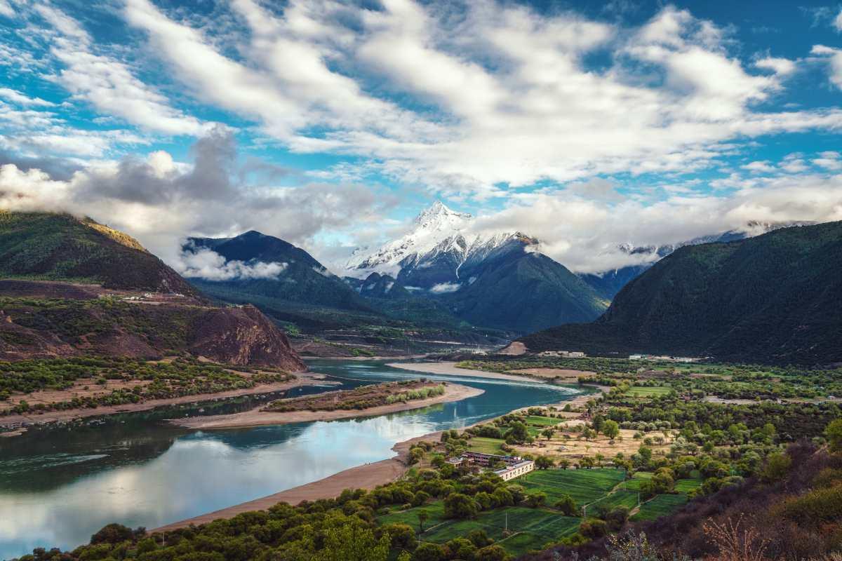
An aerial view of the Yarlung Zangbo River.
A satellite image taken by NASA captured one of the most tangled, or braided, sections of the Yarlung Zangbo River. This part of the water body is located in Zhanang County, just before it drops into the Yarlung Tsangpo Grand Canyon. At this stretch, the river’s braided pattern is so complex that it splits it into as many as 20 separate channels, and changes almost every year. So, to study these changes over the years, scientists created a time-lapse video using satellite images from Landsat 5, 8, and 9, spanning from 1988 to 2025, as reported by Live Science. The resulting video clearly shows how the river reshapes itself.
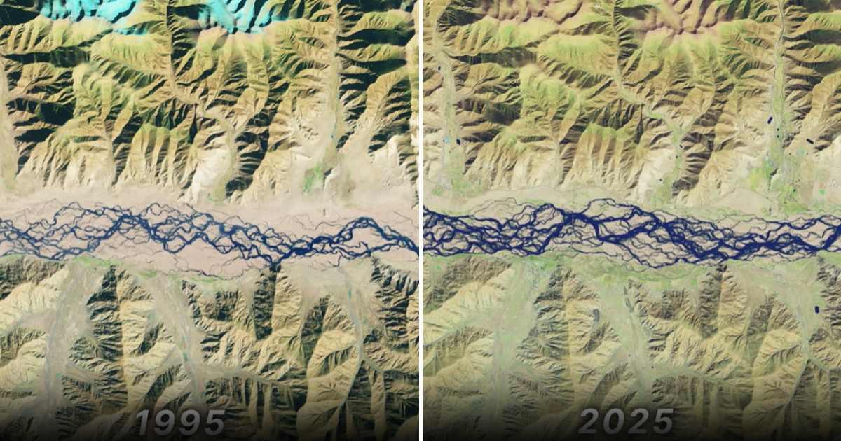
A satellite view of the braided river in 1995 and 2025.
Zoltán Sylvester, a popular geologist from the University of Texas at Austin, spoke to NASA’s Earth Observatory and revealed that the Yarlung Zangbo River’s unusual braided appearance is a result of the massive amounts of sediment carried into it from the steep slopes of the nearby Himalayan mountains. This sediment doesn’t just travel downstream—it plays a major role in carving out new channels and forcing the river water to split in different directions. He further revealed that the river shifts so frequently that it is nearly impossible to see any kind of vegetation on the sandbars that form and disappear between the braided channels.
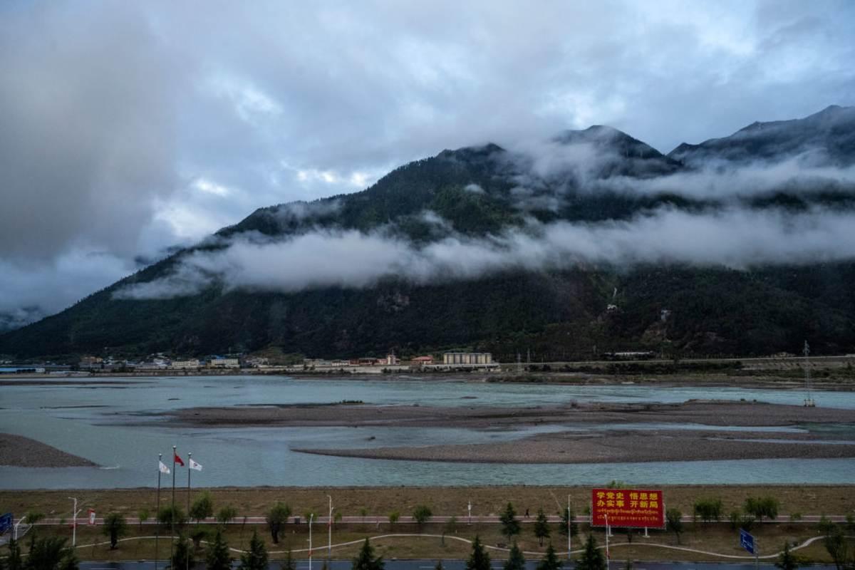
A beautiful view of the Yarlung Zangbo River.
Sylvester said, “This is in contrast with meandering rivers or anabranching rivers, in which sediment accumulations are more stable than the bars of braided rivers.” Furthermore, it is worth noting that the river begins its journey from the Angsi Glacier, where melting ice creates a stream that eventually grows into the Yarlung Zangbo River. Along its way, there’s a point where the river enters India and joins the Brahmaputra River. However, just like several other glaciers surrounding the Himalayan region, the Angsi Glacier has also begun to shrink at a rapid rate in the past few decades, mainly because of human-driven climate change.
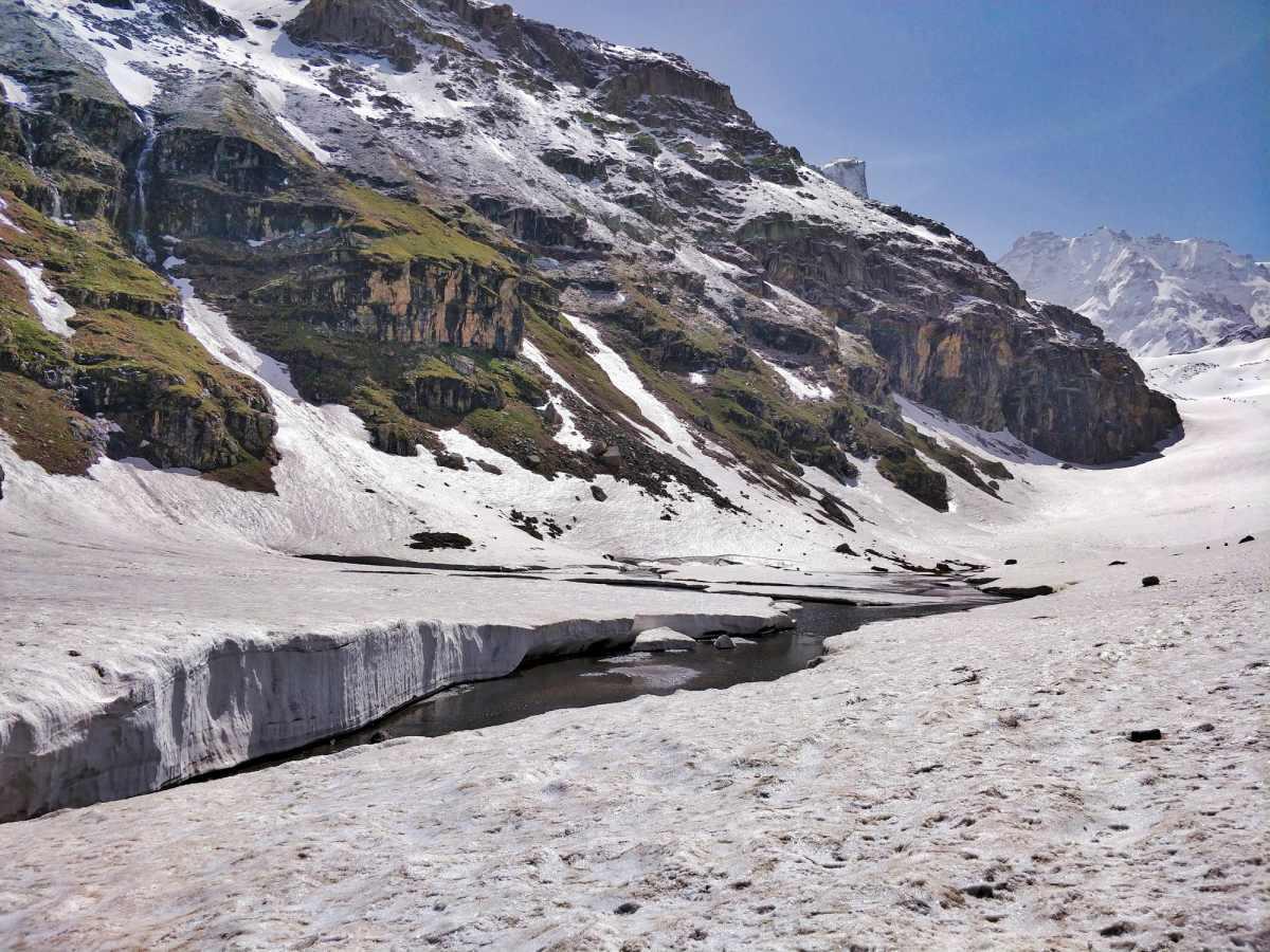
A melting Himalayan glacier.
As the ice melts, it releases more water into the streams that feed the braided river, and this extra meltwater carries more sediment downstream. This not just reshapes the riverbed but also speeds up erosion near the banks. A 2024 study, published by the National Library of Medicine, that examined satellite images of Tibet’s 13 main rivers further warned that these changes in the flow of rivers might harm the local ecosystems, nearby infrastructure, and the livelihoods of local communities.